Technical Maps
Inventory of historical and recent technical maps, pertinent to the Salave Gold Project.
Concession Boundaries
EMC Gold owns 100% of the Salave gold deposit through its wholly owned Spanish subsidiary Exploraciones Mineras del Cantábrico. The EMC Gold tenure includes five Mining Concessions and associated extensions covering 662 ha and an Investigation Permit covering another 2,765 ha.
Click to Enlarge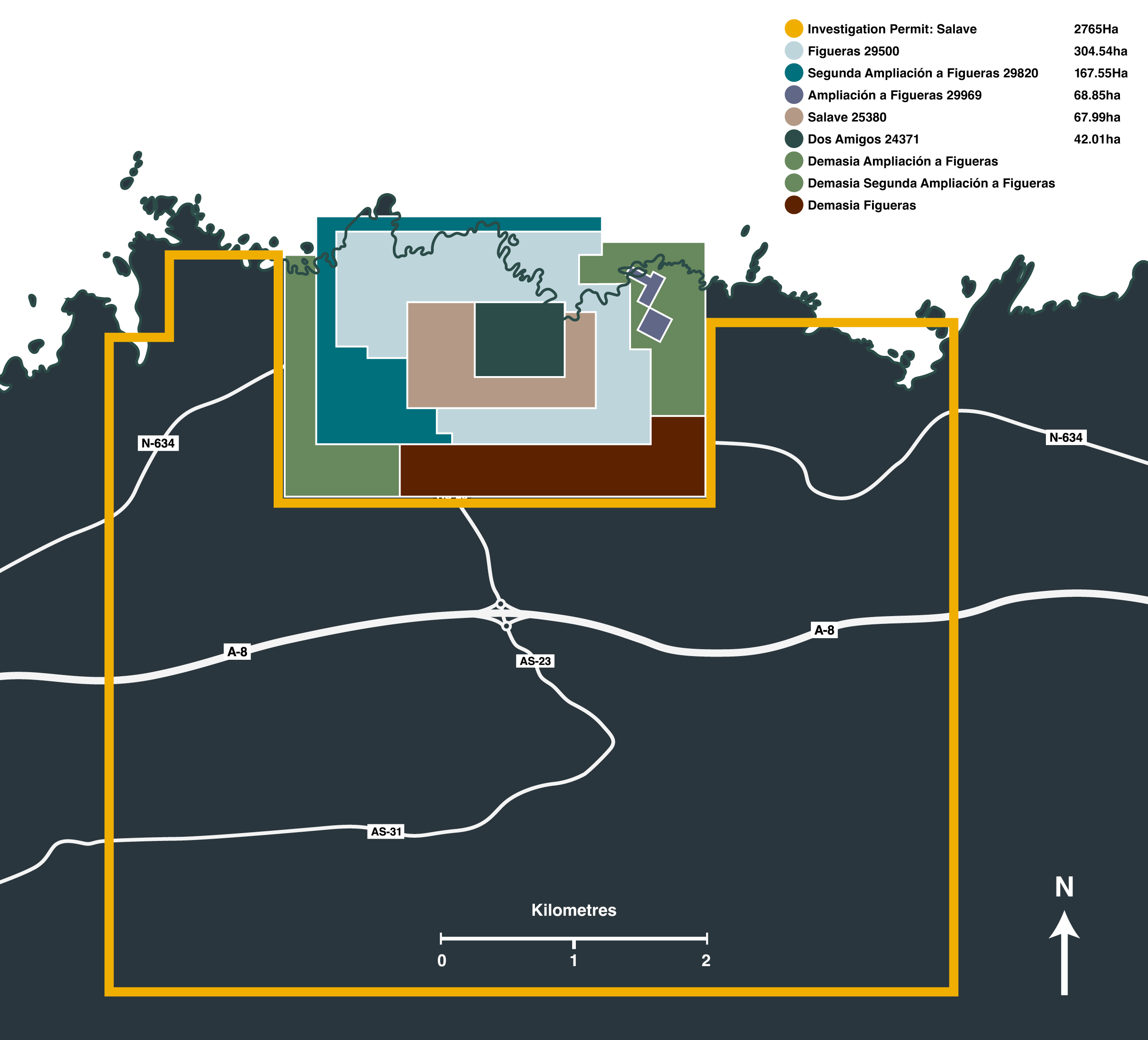
Spanish Overview Map
The Salave project lies in an area north of a typical alpine forest, with moderate to rugged topographic relief characterised by narrow valleys and alpine meadows on high hills. The general area is characterised by a coastal plain forming an east-west strip approximately 5 km wide, with relief ranging from 10 m to 50 m. It is backed to the south by the Cantabrian Range, a mountainous area that extends along the entire northern coastline of Spain. The plain slopes gently to the north from the foot of the mountains and terminates abruptly at the coast.
Click to Enlarge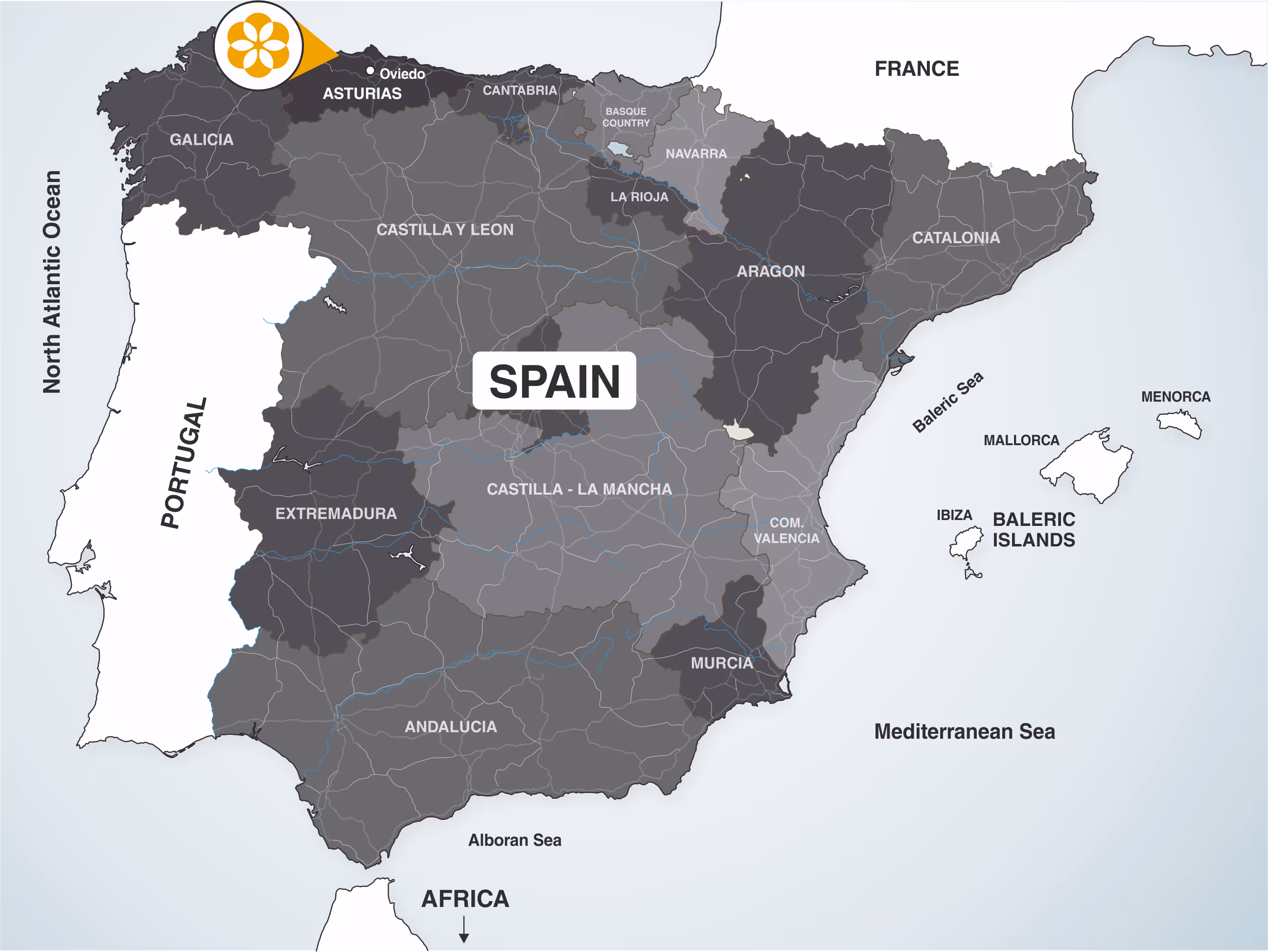
Historical Drilling
A significant amount of drilling has been undertaken at the project, with 484 drill holes for 69,586 m completed prior to the 2018 program. This drilling commenced in 1970 and continued until 2013. EMC Gold commenced a seven diamond drill holes program in February 2018, the first to be undertaken since 2013.
Click to Enlarge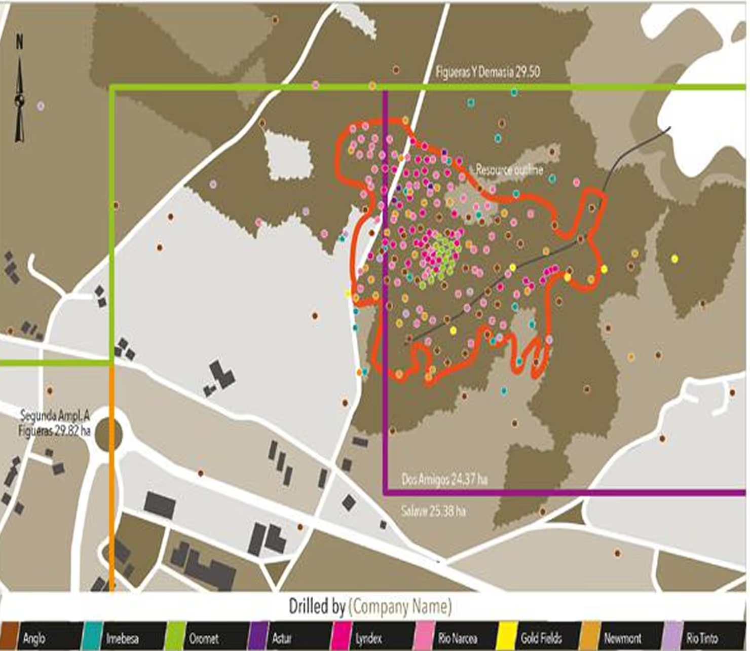
Asturias Overview
The Salave gold deposit is situated on the northern coast of the Iberian Peninsula, in the Asturias region of Spain. The nearest village is Tapia de Casariego (population 3,500) about two kilometres west of the Salave gold project. The nearest city is Oviedo (population 220,000) about 140 km east of the project (2012 population, Instituto Nacional de Estadistica).
Click to Enlarge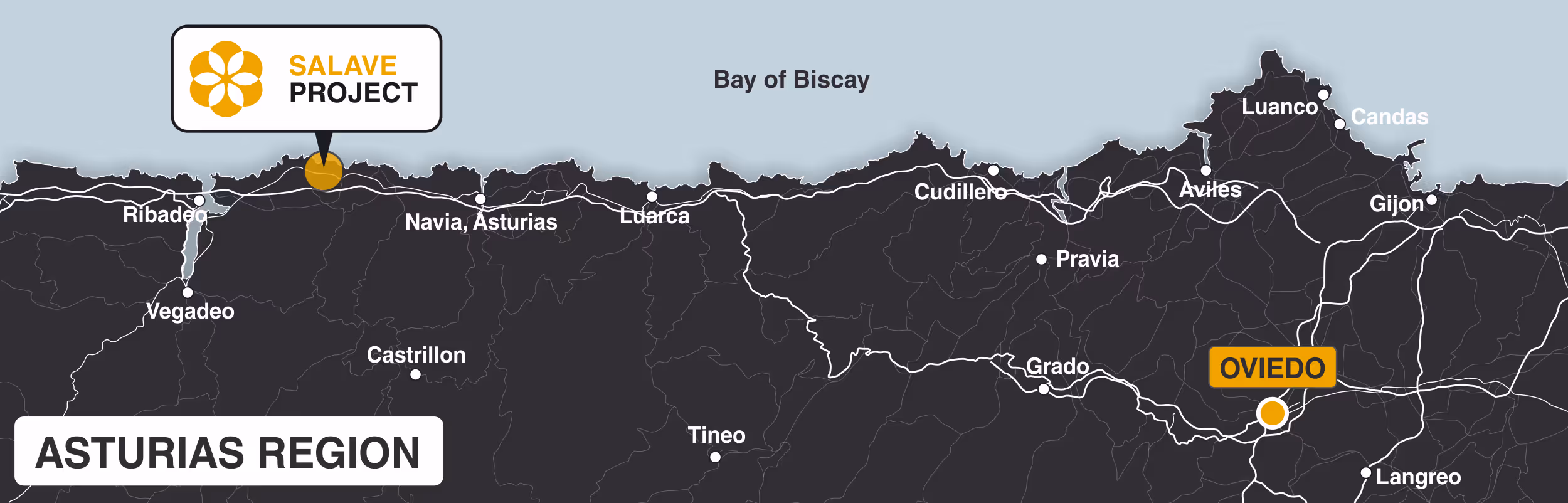
Magnetic Map
In 2019, EMC completed a 760-line kilometre, high-resolution, airborne magnetic and radiometric, survey over the entire, 3,427 ha Salave Project. The survey succeeded in enhancing EMC’s understanding of the geology and identifying additional exploration targets within the Company’s investigative permit area
Click to Enlarge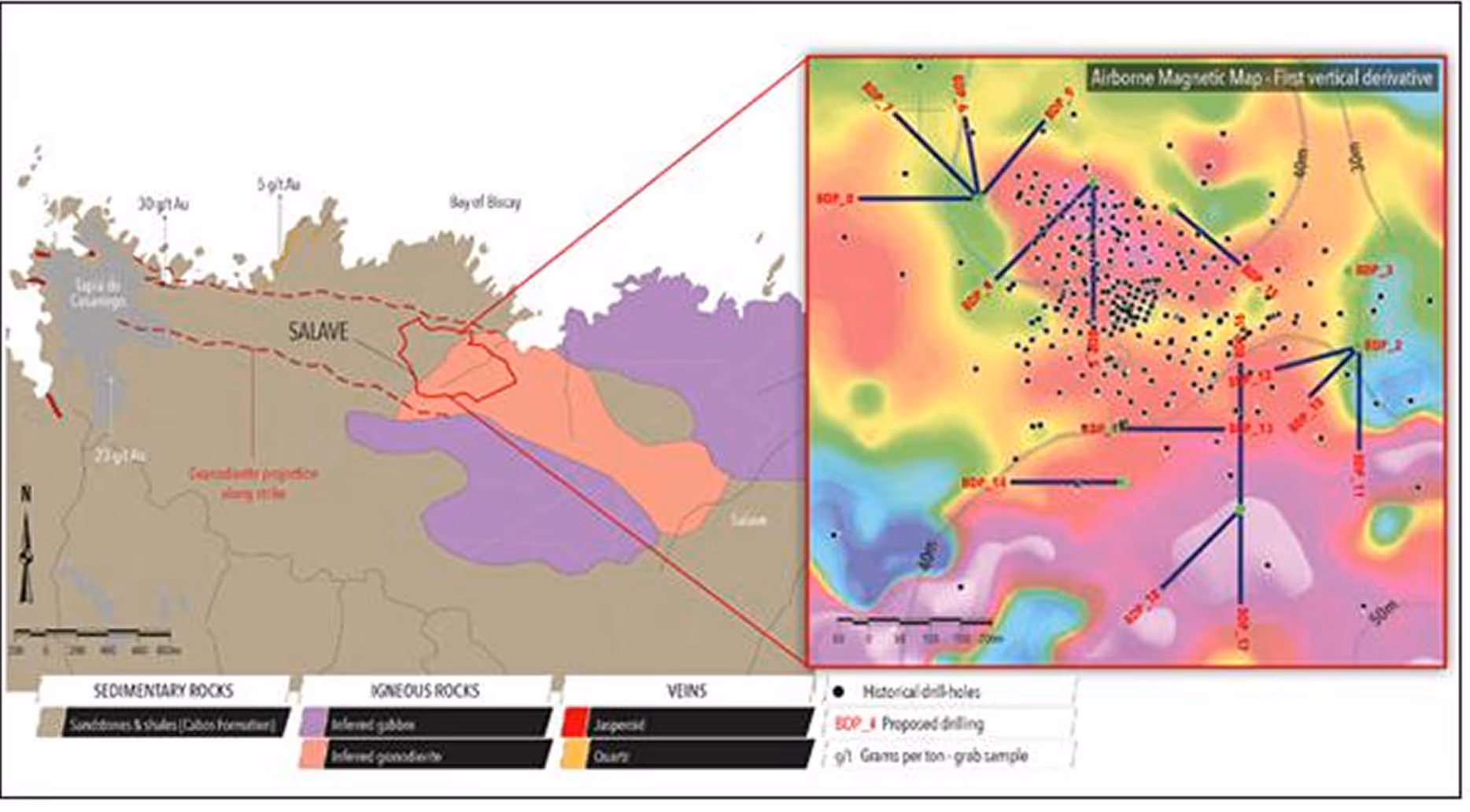
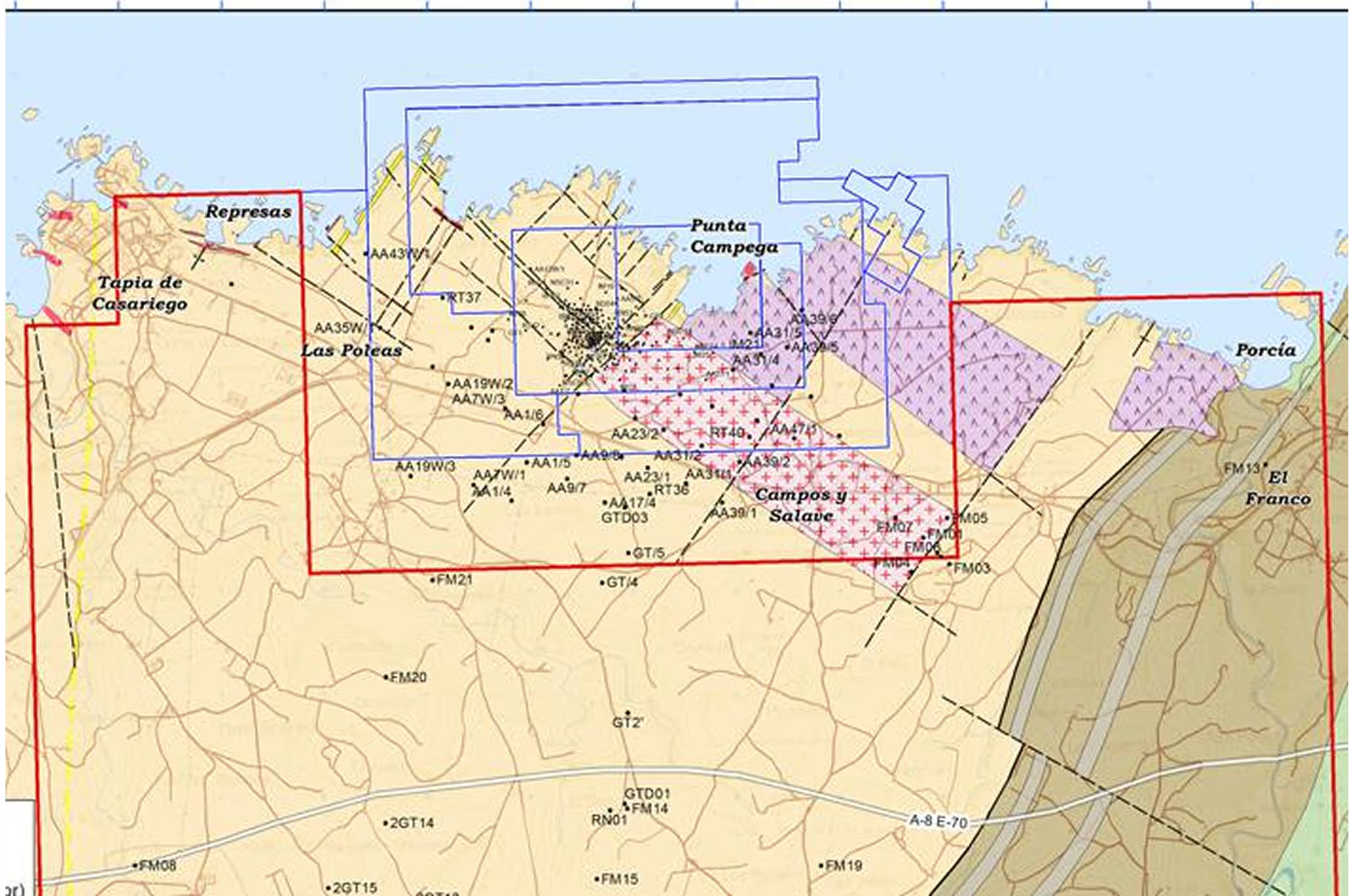
Compilation Map
A compilation map of the Salave Gold Project with drillhole collars, localities and geology. NB: The geological interpretation pre-dates the interpretation of the 2019 airborne magnetic survey.
Click to Enlarge